Bishop’s Glen is one of the best “hidden in plain sight” stories in Lost Dunoon. People know it as a walk, a viewpoint and a piece of attractive landscape. Fewer realise that it was also a deliberately engineered water-supply system, once more complex than the present ground makes obvious.
Historic image gallery
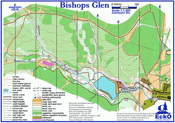
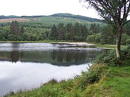
Orientation images for the glen and its waterworks story. The map evidence matters at least as much as the photographs here.

What it was
Bishop’s Glen, earlier known as Balgaidh Glen, became part of Dunoon’s municipal water-supply system in the late nineteenth century. The key point is not just that there was a reservoir here. There were three. The glen was an engineered landscape of basins, embankments, controlled flow and associated works serving the town below.
That matters because the place can now be misread as mainly scenic ground. Historically, it was both scenic and functional. The water system gave Dunoon a piece of critical infrastructure tucked into one of its most attractive landscapes.
What was lost
The biggest loss is not simply two vanished reservoirs. It is the loss of legibility. Dunoon lost:
- the full three-reservoir layout as something ordinary walkers could still recognise
- much of the visible infrastructure that explained how the system worked
- the public sense that this glen was once an engineered utility landscape rather than only a recreational one
- the everyday local knowledge of where reservoirs 2 and 3 actually sat
What remains now
One principal reservoir still reads clearly on the ground. Beyond that, the story survives through altered contours, embankment hints, water-course logic, old mapping, council interpretation and local walking knowledge. This is a page where maps do more of the work than surviving fabric.
Then / Now compare
Three-part system
Historic mapping is the clearest way to see the full waterworks layout. Grid Ghosts is the best entry point because it makes the wider shape of the glen readable again.
Beauty spot with hidden engineering
The present walk reveals one basin clearly and leaves the rest to interpretation. The modern landscape is quieter, simpler and easier to misread.
Bishop’s Glen cluster
Why it matters
Castle Hill gives Lost Dunoon its medieval anchor. The lido gives it a tourism-era symbol. Bishop’s Glen gives it a third kind of flagship page: infrastructure disguised as scenery. It shows how Dunoon’s history is not only about castles and demolished buildings, but also about systems that retreated from view while continuing to shape the town.