Modern street alignments mask an earlier layout in which Argyll Street did not yet run to the pier and open ground occupied part of the centre.
Historic image gallery
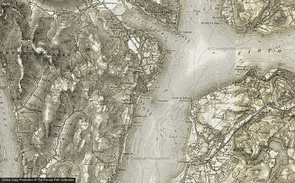
Archival and reference images collected for this page. They are here to help fix the place in memory, not to act as the final caption set.

Then / Now compare
Historic reading
This is the purest map-comparison page: line up older OS sheets with current mapping and watch the town push out toward the pier.
Present landscape
The current centre feels permanent, but the compare view shows how much was infill and extension.
What it was
Before the later nineteenth-century build-out, Dunoon’s centre had a different spatial logic, with streets and open ground laid out in ways now easy to miss.
What was lost
An older town pattern and the visual transition between the older core and later expansion.
What remains now
Pieces of plot history and the ability to reconstruct the change through maps and photographs.
Research leads
Use side-by-side map comparisons to show precisely where the centre was opened up and rationalised.